Geographical and chronological information of the fiscal and spatial expansion of the Spanish Empire in the New World during the 18th century.
Link to the maps here
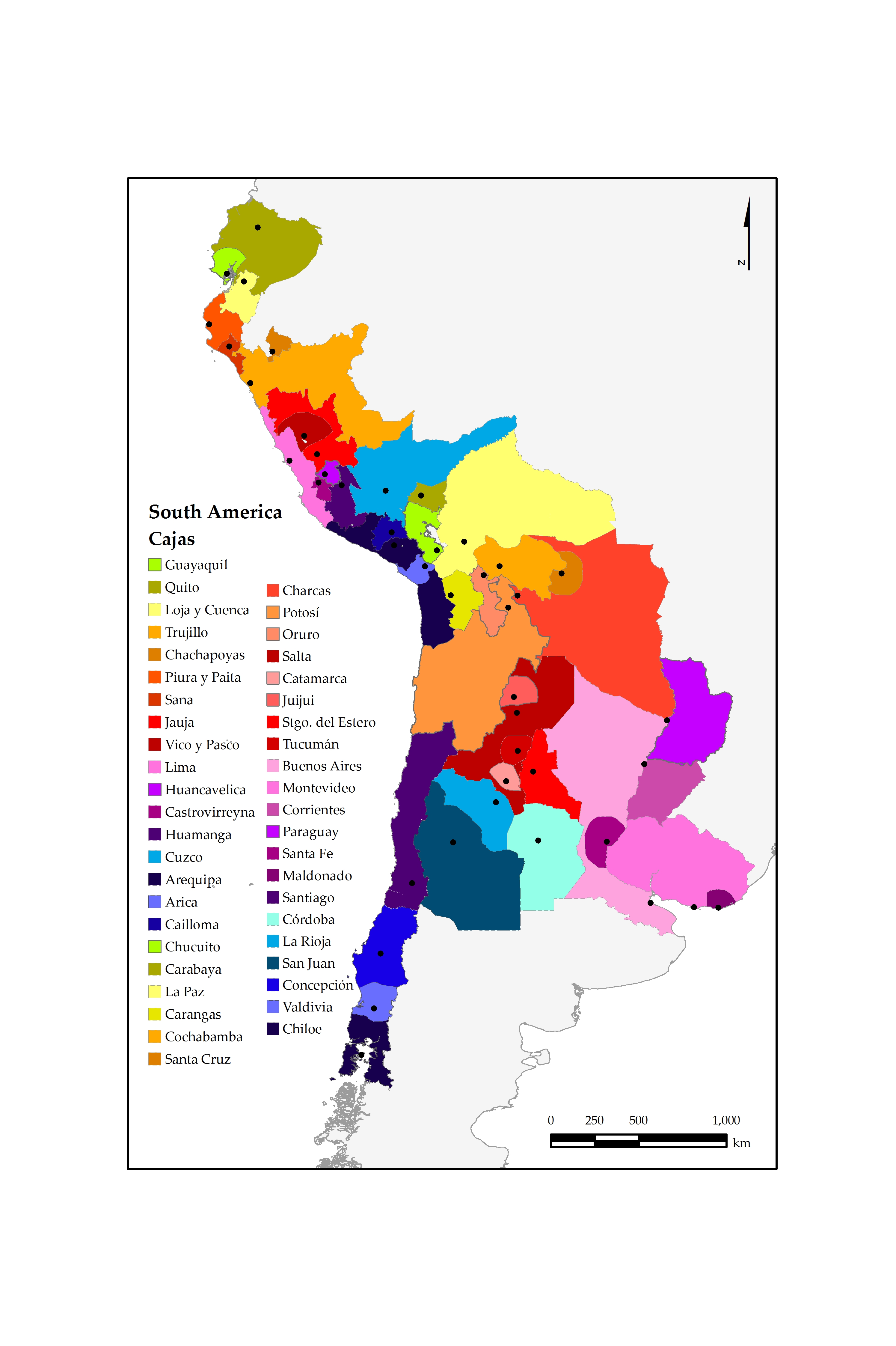
A set of 24 GIS maps containing historical information on 21 fiscal districts in New Spain (today Mexico) and 44 fiscal districts in South America (present day Colombia, Ecuador, Peru, Chile, Bolivia, Argentina, Paraguay and Uruguay) showing
1) the territorial extension of each district,
2) the year of creation,
3) the amount of revenues,
4) the amount of expenditures,
5) the amount of transfer among the districts (all in Spanish silver pesos), and
6) and the order of importance of the transfer as proportion of net revenues (in percentages) for New Spain (today Mexico) and South America (present day Colombia, Ecuador, Peru, Bolivia, Chile, Argentina, Paraguay and Uruguay) for the periods 1729-1732, 1785-1789 and 1796-1800.
This historical information is original and to date has not been available to scholars. It has been collected and organized in GIS format thanks to the support of the British Academy Small Grant SG 113363 for the project ‘The rise and collapse of a stakeholder empire: the political economy of Spanish America 17th-19th centuries’. The grant holder gratefully acknowledges the support of the Academy.