The highest temperature ever recorded in the UK – 38.7C – has been confirmed by the Met Office.
The measurement, taken at Cambridge Botanic Garden last Thursday, was subject to quality control and analysis by meteorologists over the weekend. The previous record of 38.5C was recorded in Faversham, Kent, in August 2003.
The recording was taken at a Met Office climate observation site at the University of Cambridge. Some observation sites report monthly, meaning there is still a chance that higher temperatures were recorded elsewhere.
Countries across central and western Europe were gripped by exceptionally high temperatures last week, with Belgium, Germany and the Netherlands also breaking national temperature records.
Scientists have said July is on track to be the hottest month ever recorded on Earth, and 2019 is expected to be the second hottest year. The hottest was 2016, which was boosted by an El Niño weather system. Nine of the 10 hottest years ever recorded have occurred since 2000.
Although the recent heatwave cannot unequivocally be attributed to global heating, scientists found it made another European heatwave in June at least five times more likely, and made the lengthy hot spell experienced by the UK last year at least 30 times more likely.
Dr Mark McCarthy, from the Met Office National Climate Information Centre, said: “Historically UK summer heatwaves would typically tend to peak in the low 30s celsius, with extreme events reaching the mid-30s. Climate change has increased the likelihood and severity of heatwave episodes across Europe, which will have also increased the risks of a 40C temperature event in the UK.”
Last week’s heatwave was caused by hot air from north Africa being pulled up from continental Europe because of high pressure to the east of the UK and low pressure to the west.
Prof Peter Stott, from the Met Office, said: “Although the average rise of global temperature is around 1C compared with pre-industrial times, we mustn’t forget that the rise isn’t even across the globe as some regions have warmed more than others.
“Temperatures in parts of north Africa, for example, have risen by around 2C. This can have a marked effect on UK weather because when the weather patterns like we saw last week bring air from this region to our shores it can bring a stronger signal of climate change with it too, boosting temperatures.
“The UK receives influences from other neighbouring regions and as many of these regions are warming at a faster rate than the UK, our climate can receive a greater boost from climate change.”
Many scientists believe the jet stream is weakening, which could help explain the increase in extended weather spells both hot and cold, such as the summer heatwave last year and the “beast from the east” in March 2018.
Bob Ward, the director of policy at the Grantham Research Institute on Climate Change, said: “Heatwaves are becoming more frequent and more intense due to climate change, and the risk of heat-related deaths is increasing. Sadly this trend will continue for the next few decades and so we will have to adapt more quickly, for instance by ensuring our buildings do not dangerously overheat.
“However, we can expect new records to be set regularly. It is inevitable that we will eventually see a temperature of more than 40C in the UK.”
More extreme weather is expected to hit the UK this week, with thunderstorms expected on Tuesday and Wednesday.
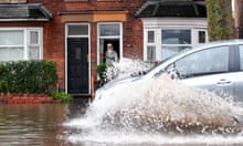
Over the weekend heavy downpours left parts of the north-west flooded, including Greater Manchester where commuters awoke to road closures and diverted trains after two weeks’ worth of rain fell in 24 hours.
Eight flood alerts remained in place across parts of the West Midlands and north-west England on Monday evening.
Kate Sambrook, a climate scientist at the University of Leeds, said high temperatures like those seen last week could become the new normal.
“Year after year we are seeing more and more extreme events, not only in the UK but worldwide. Last week temperature records were not just broken, they were smashed by 1C or more, which is unprecedented,” she said.
“We need to act now to urgently and decisively bring greenhouse emissions to zero. We must halve emissions in 10 years and reach net zero in 30. If we don’t, we can expect global temperatures 3.7C warmer by 2100 and still rising.”


